Digital Forest Inventory for Plantation Forestry

LiDAR-based forest data for accurate inventory, better decisions, and efficient plantation management.

How DFI Plantation works

DFI Plantation turns LiDAR scans into usable inventory data. From field capture to maps, reports, and analytics, all in one workflow.

01

Define plots

As part of the preparation

03

Scan trees

Capture data with the LiDAR scanner

04

Upload data

Automatically via app

06

API integration

Export or connect to your tools

05

View results in DFI

View data and map settings

02

Navigate to the plot

Using the TreeScan app

DFI Plantaion is one platform for two user groups

DFI Plantation

For Inventory Companies

Capture data faster, reduce manual work, and deliver consistent inventory results across projects.
Key benefits:

DFI Plantation

For Forest Owners

Use one reliable source of forest data for planning, reporting, and operational decisions.

Key benefits:

Key modules of the DFI Plantation platform

The DFI system connects LiDAR-based field measurement with digital forest analytics, supporting reporting, planning, and long-term plantation management.

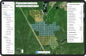
Digital forest mapping

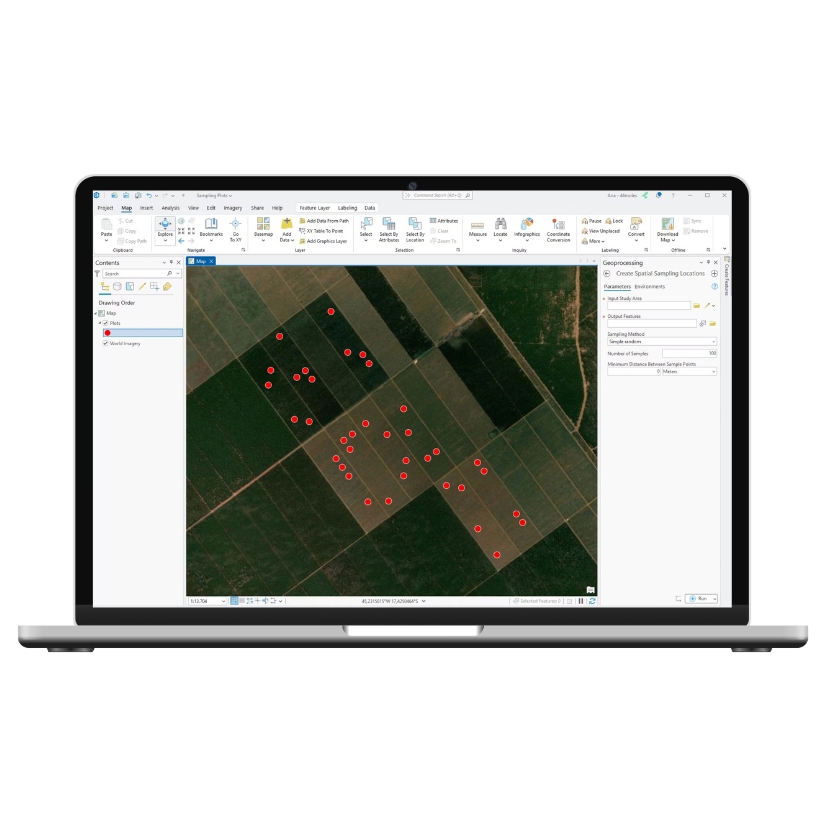
All inventory data is saved within a GIS-based environment, linking plots, stands, and key statistics in one consistent system.

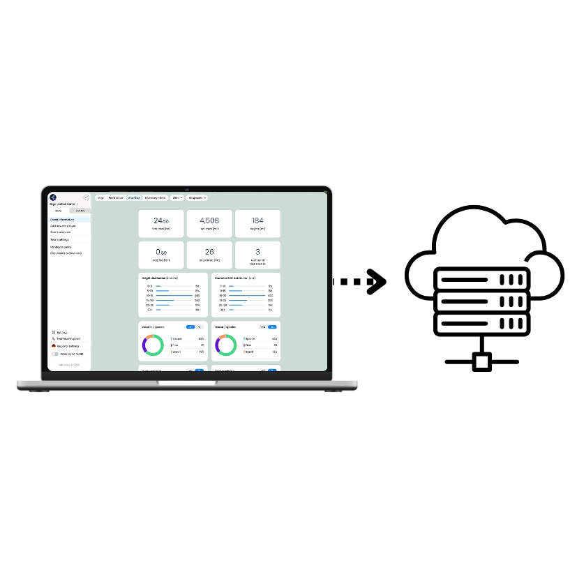
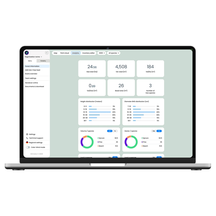
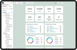
Analytics & reporting

Standardized datasets and flexible parameter combinations support reporting, documentation, and long-term comparison.

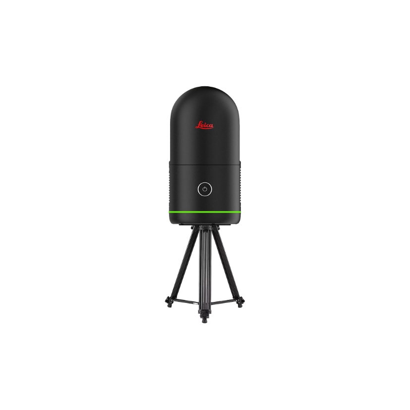
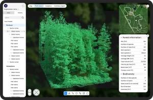
Point cloud visualization

Each plot includes a LiDAR-based 3D representation, enabling virtual review of forest structure and stand characteristics.

Our expertise

15

years in forest inventory

18

years in scientific research

11

years in software development

Book your live demo

Select a time and one of our team members will meet you via Microsoft Teams for a 30-minute live walkthrough of DFI Plantation.

New business & inquiries

Integration & GIS Expert